


It allows Android-based devices to design flight plans for DJI drones, autonomously control them, keep a log of the flight, and save captured aerial footage.


Our client offers aerial intelligence services and supports in-house drone programs for small businesses and enterprises. They collect and analyze aerial data to assist clients in making informed decisions. While they had a web version and an iOS application, they needed an Android application to reach a wider user base. EffectiveSoft was tasked with developing the Android application to meet their requirements.
Aerial intelligence services company
Aerial Intelligence
Android app
Android, Kotlin
Among the requirements was full compatibility with DJI drones and a similar look and feel to the iOS application.
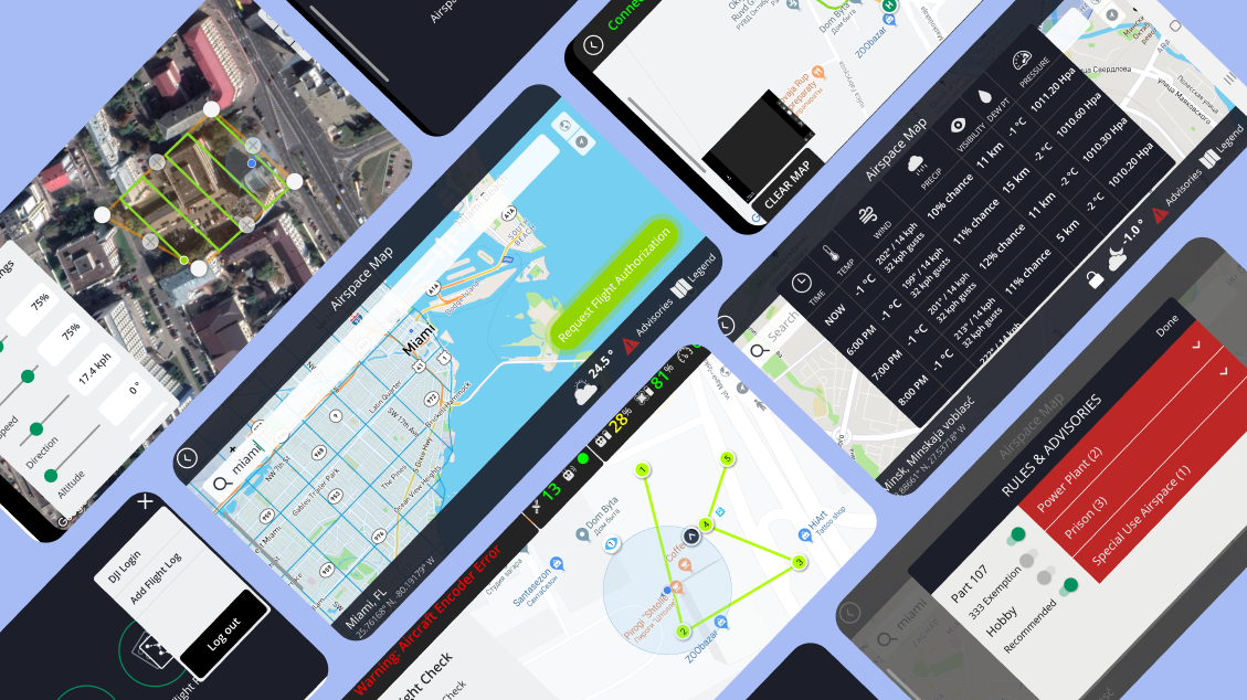
One of the main challenges was to create a grid-type flight feature, where pilots could define a flight area and the application would generate the flight plan and capture points for imagery. The drone would then autonomously follow the flight plan and capture the approved imagery
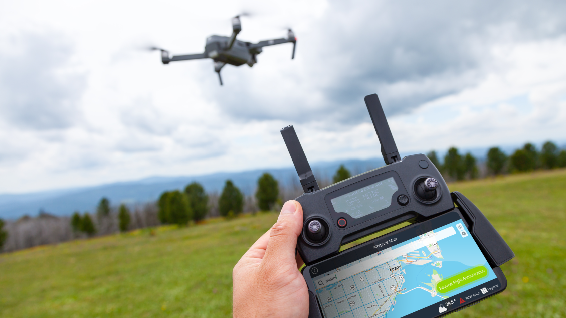
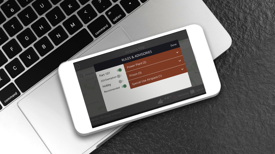
The drone flight application for Android is part of a comprehensive software solution that enables businesses to deploy and scale their drone programs. It facilitates the collection, management, and interpretation of drone data, allowing businesses to make data-driven decisions. The application is fully compatible with DJI drones and ensures safe and efficient flying while gathering high-quality information. Key features of the application include enhanced data privacy and security, integrated airspace maps, advanced drone program management tools, and user-friendly grid and waypoint flights.
If you are looking to streamline your logistics operations, contact us today to learn more about our custom logistics software development services.
The data from the mobile device is transferred to the servers, where it is processed and analyzed, thus transforming raw data into actionable data insights.
Complex planning of an autonomous flight is simple and safe with just a few taps.
A pilot can download and see the flight plans of other pilots registered in the system.
Real-time video feed from the drone camera is displayed on the mobile device.
Pilots create missions for gathering the data related to a specific task in one place, thus improving project management.
A pilot can use active track modes, such as spotlight (when the aircraft camera automatically follows the subject by rotating the aircraft’s yaw), tripod (for accurate framing at reduced speed), POI (when the drone repeatedly flies circles of a constant radius around a specified point), and trace (when the aircraft moves in behind the subject keeping a constant distance to it).
Flight logs, screen captures, and completed checklists are automatically uploaded when the flight is over (in case there is a connection problem, the data is stored locally and uploaded to the cloud when the application is launched next time with a stable connection.
Our team would love to hear from you.
Fill out the form, and we’ve got you covered.
What happens next?
San Diego, California
4445 Eastgate Mall, Suite 200
92121, 1-800-288-9659
San Francisco, California
50 California St #1500
94111, 1-800-288-9659
Pittsburgh, Pennsylvania
One Oxford Centre, 500 Grant St Suite 2900
15219, 1-800-288-9659
Durham, North Carolina
RTP Meridian, 2530 Meridian Pkwy Suite 300
27713, 1-800-288-9659
San Jose, Costa Rica
C. 118B, Trejos Montealegre
10203, 1-800-288-9659


